

land battle

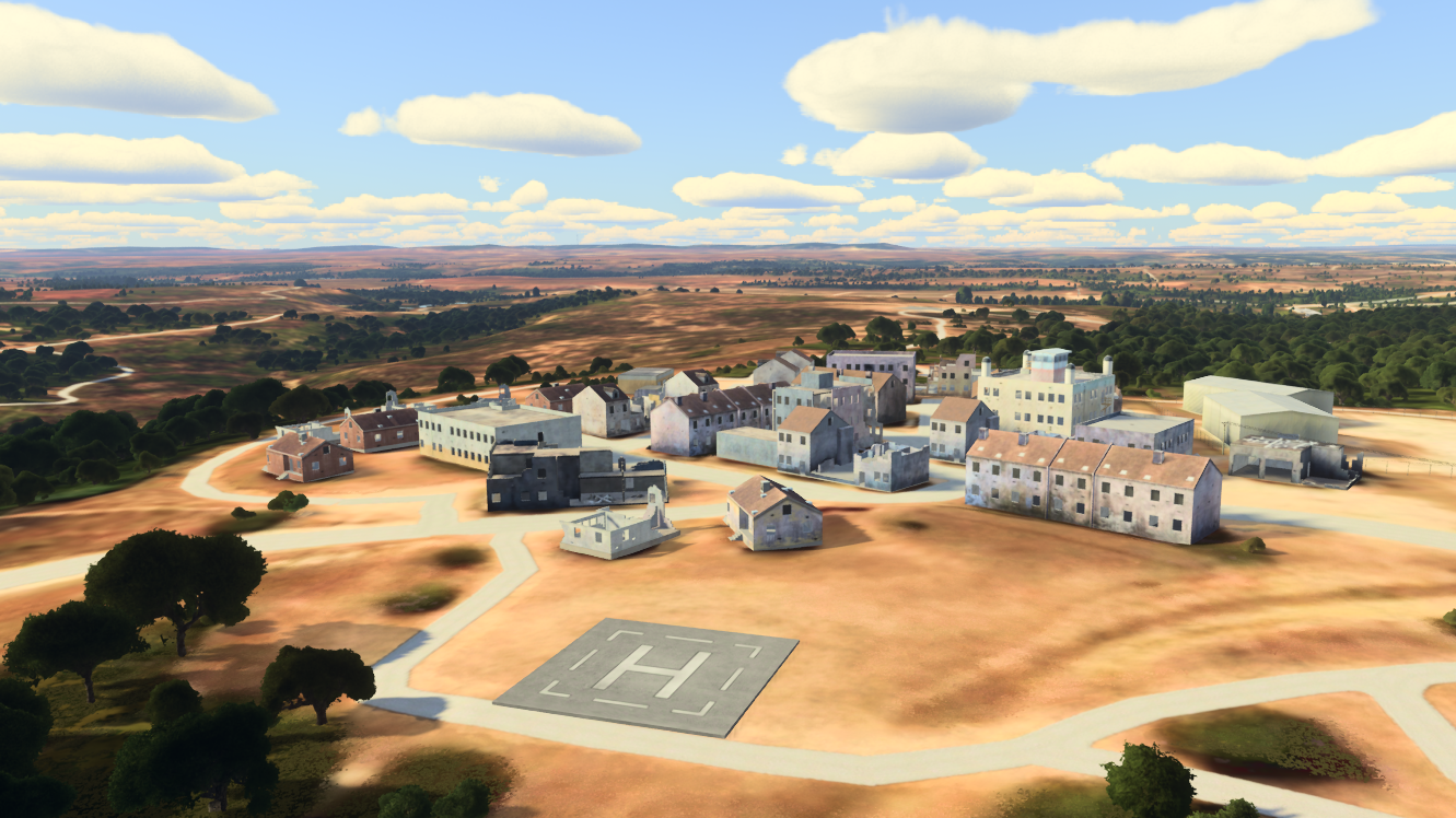
Examples of realistic 3D terrain created by Maxar Intelligence to support programs such as the Army's One World Terrain. (Maxar)
WASHINGTON — Maxar Intelligence has been awarded the Phase 4 contract for the Army's One World Terrain virtual mapping project, the company announced today.
Managed by Army Futures Command's STE Cross Functional Team, OWT aims to create a 3D global map that soldiers can use to train for combat missions in a synthetic environment. Maxar, a leading operator of Earth imaging satellites, provides 2D images before the software renders his 3D model of the terrain.
This is a key driver for the military as it seeks to improve the training of its soldiers. Army officials have also previously said they believe the map could be used for positioning, navigation and timing in GPS-denied environments.
It's no shock that Maxar, which has been working on OWT since 2019, has been given permission to continue its efforts. But it is a sign that the Army's significant modernization efforts are moving forward.
“Maxar supports the Army's modernization efforts through the One World Terrain program, a forward-looking solution that enables more sophisticated modeling, simulation, and training systems to optimize warfighter readiness. “We are proud to play an important role in helping the U.S. government,” said Suzanne Hake, Maxar's general manager, in a statement.
“This latest award reflects the unique value of our 3D geospatial data in military simulation use cases. It provides a highly accurate 3D representation of the Earth, including excellent accuracy.