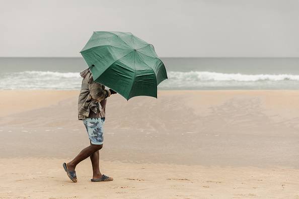
Local holidaymakers brave the elements, using umbrellas to protect themselves from the rain at Durban's South Beach on Boxing Day 2023. (Photo: RAJESH JANTILAL/AFP via Getty Images)
South Africa is expected to experience a wet summer that could cause flooding in parts of the country and higher than normal temperatures, according to meteorologist Lehlohonolo Thobela of the South African Weather Service.
“Above normal rainfall is expected in the central and eastern parts of the country. Therefore, eastern states may experience more intense rainfall as well as thunderstorms that may cause heavy rains and flooding,” Thobera said. Mail & Guardian.
Despite the rains, warmer temperatures are expected across the country during the summer, he said.
Snow fell across much of the country last weekend, closing major roads, stranding drivers and destroying livestock and crops.
Heavy snowfall was recorded in Gauteng, Free State, Mpumalanga, KwaZulu-Natal and the Eastern Cape, causing massive traffic jams between the Free State and KwaZulu-Natal provinces, trapping thousands of motorists for up to 13 hours on one of the country's busiest roads.
“The snow fell due to cold conditions and ample moisture in the area. These conditions were created by a weather system known as a cut-off low and a cold front located east of South Africa.”
“These weather systems have produced a lot of moisture that has led to freezing drops, cooler temperatures, rain and snow,” Thobera said.
Cut-off depressions are pressure systems that develop higher in the atmosphere that are separated from the normal westerly wind flow. They are linked to weather systems that develop at the surface or lower in the atmosphere, making them more powerful, according to Kanisa Makubalo, a forecaster with the South African Weather Service.
Researchers are studying whether such events are happening more frequently and more intensely, Neville Swade, director of the Cooperative Association for Climate and Earth System Science, previously said. M&G.
“A rapid recovery in daytime temperatures is expected across eastern South Africa from Sunday into Monday,” the weather service said in a statement.
El Niño and La Niña are warm and cold phases of weather patterns that bring warmer and cooler or cooler and wetter weather, respectively. They are commonly referred to as ENSO.
“ENSO remains neutral and is forecast to weaken further, but current forecasts are mixed on whether it will weaken toward a La Niña event next summer.
“With improved forecasting capabilities, significant changes in the ENSO system are possible over the winter months and beyond, so monitoring the ENSO system is advised,” the weather service said.
“We are seeing signs of a La Niña event approaching that could affect the summer season, bringing above-average rainfall to most of the summer rainy regions. [October, November and December]Initial forecasts suggest there will be plenty of rainfall over the summer.
“However, Limpopo province is an exception, where below-normal rainfall is expected even into early summer. Dry weather is expected to continue across the country through spring,” it said.
Weather patterns are expected to affect agriculture.
“Below-normal rainfall is forecast for most parts of the country in early and mid- to late spring, except in some parts of the Free State province.”
“Conversely, above-normal rainfall is expected in early summer across most parts of the summer rainfall region, except Limpopo Province. The forecast above-normal rainfall in these summer rainfall regions is likely to have a positive impact on crop and livestock production,” the weather bureau said.
However, Limpopo province is expected to experience lower than average rainfall in early summer.
The weather bureau encouraged farmers to “implement soil and water conservation measures, proper water collection and storage techniques, establish effective drainage systems and adopt other good agricultural practices.”

